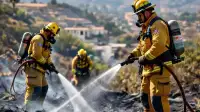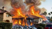

Santa Ana winds, rising temperatures, and critically low humidity are creating high wildfire risk across much of the Southland this week, with conditions expected to peak Thursday and Friday. The National Weather Service (NWS) has issued Red Flag Warnings for critical fire danger across much of Los Angeles County, effective from 6 a.m. Thursday through 10 p.m. Friday.
Temperatures will climb, reaching the upper 80s and low 90s in most coastal and valley locations by Thursday. This warming trend, which began Wednesday with a 5 to 10-degree rise over Tuesday, will see another 4 to 8 degrees added Thursday as Santa Ana winds intensify. Forecasters noted that this warm-up is distinct from earlier heat events, as it will be accompanied by "single-digit humidities typical of a Santa Ana event." Temperatures are projected to be roughly 10 degrees above normal in many areas and 15 to 18 degrees above normal along the coast by Friday, when winds are expected to be at their strongest.
On Wednesday morning, winds of 40 to 50 mph were already recorded in some mountain areas, with gusts of 25 to 35 mph in the western San Fernando Valley. During the peak on Thursday and Friday, the NWS predicts northeast winds of 20 to 40 mph, with gusts up to 40 to 60 mph, will be common over wind-prone areas of Los Angeles and Ventura Counties. Localized gusts could reach 60 to 70 mph in the mountains. Beyond the Red Flag Warnings, the NWS also issued wind advisories from 6 a.m. Thursday through 8 p.m. Friday for the Malibu Coast, the Santa Clarita and San Fernando valleys, and the Eastern Santa Monica Mountains Recreational Area. A high wind watch is in effect from Thursday morning through Friday evening for the Western Santa Monica Mountains Recreational Area and San Gabriel Mountains. Mountain areas could see humidity levels fall to between 8% and 20%, while other regions might experience winds of 20 to 30 mph, gusting to 50 mph, and humidity dropping as low as 5%.
The Red Flag Warnings specifically cover the Santa Monica Mountains Recreational Area, San Gabriel Mountains, the Golden State (5) and Antelope Valley (14) freeway corridors, Antelope Valley foothills, the Malibu Coast, Calabasas, and the Santa Clarita, San Fernando, and San Gabriel valleys. Forecasters stated that "A red flag warning means that critical fire weather conditions are either occurring now, or will shortly." They urged residents near wildland interfaces to be prepared to evacuate if a wildfire breaks out and to use extreme caution with anything that can spark a wildfire.
The hot, dry, and windy conditions raise the potential for Southern California Edison (SCE) to implement public safety power shutoffs (PSPS) to mitigate wildfire risk from power lines. As of Wednesday afternoon, SCE’s website indicated that over 89,400 customers in Los Angeles County were under consideration for possible power shutoffs, though none had occurred yet. Malibu officials reported on Tuesday that SCE had notified the city of potential shutoffs as early as midnight Thursday on specific circuits in central and western Malibu (Cuthbert, Galahad, Maguire, and Merlin). Residents are urged to charge electronic devices, prepare emergency supplies, review evacuation routes, and secure loose outdoor items. The NWS also cautioned drivers about dangerous crosswinds, especially on elevated roadways.
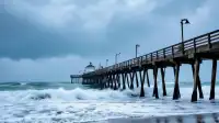
Heat advisories will be in effect from 10 a.m. Thursday through Saturday for the Malibu Coast, Los Angeles County beaches, Palos Verdes Hills, and the Inland Coast, including downtown Los Angeles. In addition, dangerous surf conditions are expected to continue along Los Angeles County beaches, with a beach hazards statement remaining in effect through Thursday afternoon. Forecasters noted that long-period swells from the west and south, combined with elevated morning tides of 6.5 to 7 feet, could lead to minor coastal flooding, particularly in low-lying beach and harbor areas of Los Angeles County. These coastal hazards follow several days of damaging surf and flooding associated with the remnants of former Tropical Storm Rachel.
Santa Ana winds could persist into Saturday, though conditions are expected to weaken over the weekend. Temperatures are forecast to remain above normal through Sunday before a significant cooling trend begins early next week.